|
|
Post by mrsquishy on Apr 26, 2013 9:54:02 GMT -9
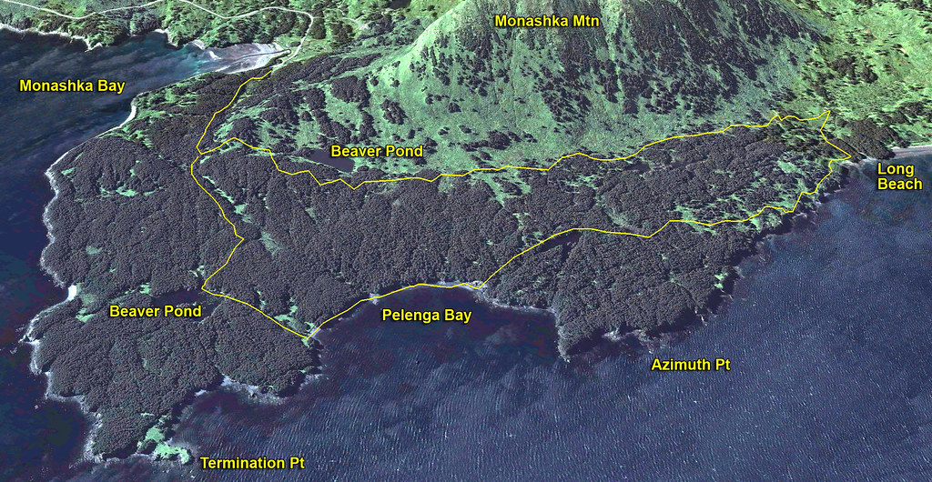
I strapped the snowshoes and microspikes on my pack and headed out the old ATV trail (aka Three Bear Cove Trail) with the intention of replicating Philip's circumnavigation of Monashaka Mountain. However, the buffeting from the winds of desire convinced me to stay low.
I followed the TBCT to the New Beaver Pond (which now covers a portion of the trail), circled around the pond, then headed S-SE through the forest to the coast along Pelenga Bay (south of Azimuth Point). I saw a few bear tracks frozen in the snow near the NBP. I followed the coastal trail to TP, then returned to the TH via the forest trail. Total mileage: 8.72 miles
Very good hiking everywhere as most of the marshes have a little water on top, but are still frozen underneath. There are well-trod game trails between TBCT and the coast and with the aid of a compass, it's an enjoyable hike. And, once you're in the woods, town seems a long way away as Philip mentioned.
|
|
|
|
Post by Philip on May 12, 2013 12:52:27 GMT -9
|
|
|
|
Post by mrsquishy on May 14, 2013 8:27:07 GMT -9
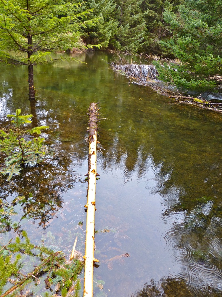
I've been pleasantly surprised that the beavers who built the dams on the ATV trail have not been trapped or shot by the ATVers. That pond seems to have pretty effectively prevented them from venturing further. When I hit the woods after hiking around the pond, I took a heading a little SE of Azimuth Point which allowed me to stay in the woods and not have too much bushwhacking. I have tried several times to hike the coast from TP to 3BC, but the terrain and vegetation west of Azimuth Point makes it extremely difficult. There is one drainage at Pelenga Bay that once was flagged that was the best entry/exit point for hiking the woods to 3BC. Last time I was there, the flagging was gone. Thanks, Philip, for the map of your route. I agree with your assessment of when to hike the woods. BTW, we same some evidence of fresh beaver activity at the TP beaver pond.
|
|
|
|
Post by mrsquishy on May 18, 2013 19:18:39 GMT -9
With the return of the "soul-sucking" wind, I opted to hike 3 Bear Cover Trail to the ocean, then up the stream to check out the new beaver dam in Philip's photos. I then followed a route SE through the forest I had stored on my GPS, following a bear trail for the first half mile or so and eventually reaching the coast just east of Azimuth Point. Followed the coast, took the short cut to the beaver pond and back to the parking through the forest. Nine miles and a very enjoyable hike. One snowshoe hare, one river otter, and one crab buoy to carry home were today's highlights.
|
|