|
|
Post by steve on Jan 17, 2022 2:12:31 GMT -9
As a general rule of thumb the further you get from the ocean and the higher in elevation you get from sea level the colder the air temp; around 3 deg. drop in temp per thousand feet. So a rain crust on Pyramid at 1000. ft. could be dry snow at 1500 ft a little further away from the ocean. I Spoke to a few people that went up behind the Flats to the second bowl on Sunday. Landing zone, 4th of July all at elevations above 1500 ft had colder, dry snow. A longer approach but also better conditions.  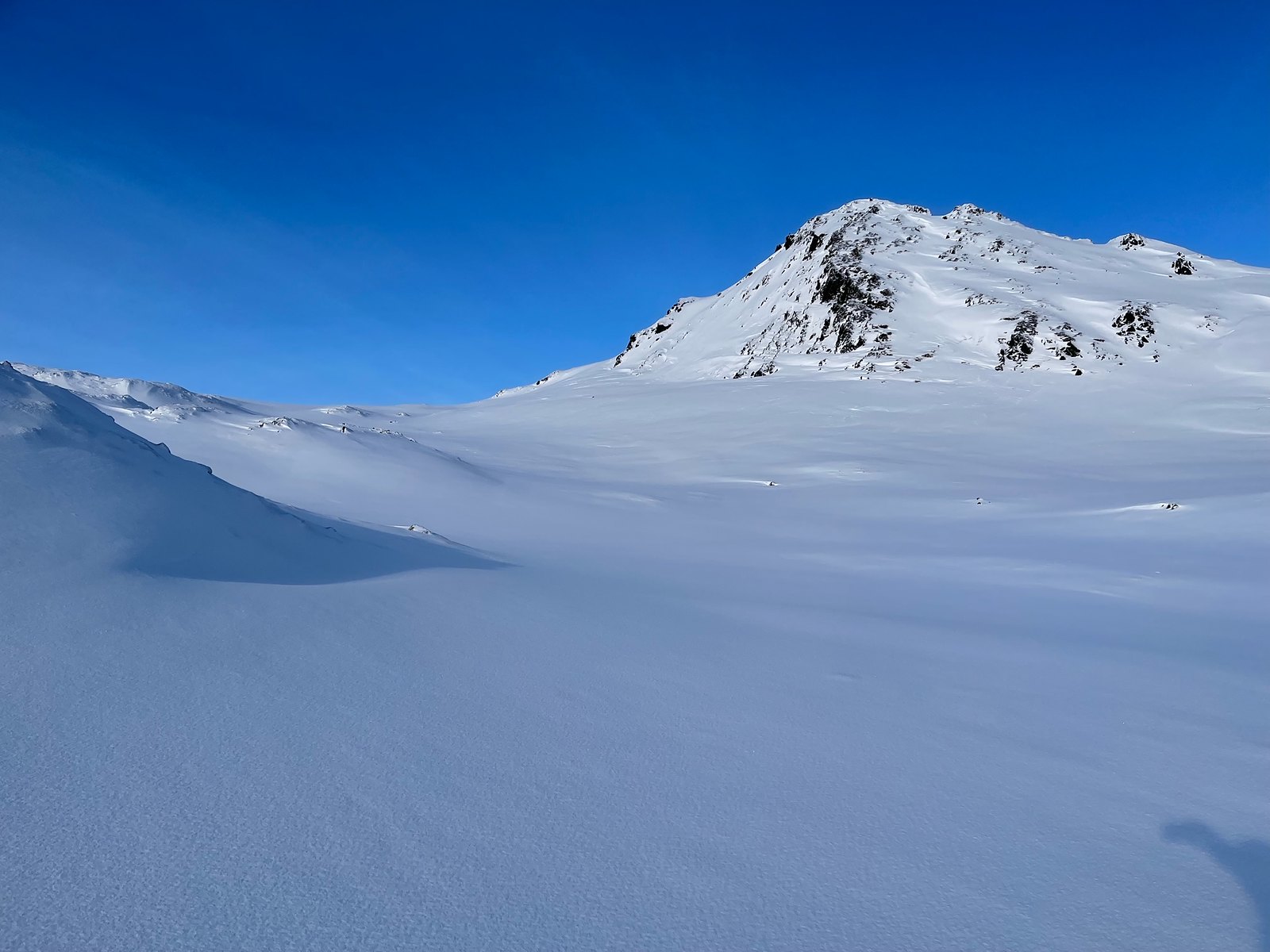 |
|
|
|
Post by gibbsm24 on Jan 17, 2022 17:49:50 GMT -9
1/17/22 Good advice Steve. I went and checked out the terrain today and found good snow. I skied a SW facing line on the ridge line near cope. The ATV trails were filled in and Sargent Creek is running low. Was able to skin from car to ridge top except briefly to cross Sargent. The snow was crusty and breakable for most of the tour. I followed the skin tracks from yesterday then broke off towards the south 2miles into the approach. It seems that 1,500ft is the magic number for the rain crust disappearing. Most avalanche signs were on western facing slopes: wet slough, roller balls and one glide crack visible to me. I also dug a snow pit 2ft deep. Multiple rain crust layers sandwiching old wind slab. Shear quality was tough and Extended Column Test did not fracture: ECTX. Snow depth was approximately 140cm. Early in the run some rocks were close to the surface: 5-10cm Windy reported the temps were ~28deg. Wind from the southwest <5mph. Definitely a stiff breeze on the ridge, no snow movement. Good tour. Good weather. Nice to get out one more time before the next wet cycle. -Gibbs South x Southwestern aspects of Cope 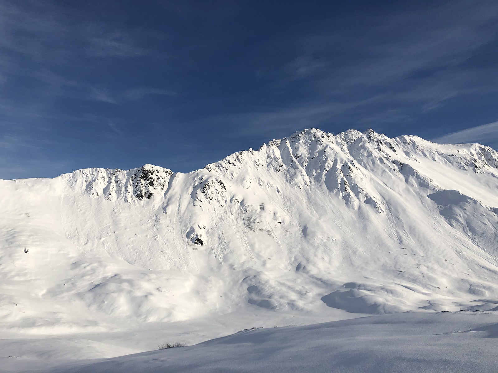 Line chosen to ski. 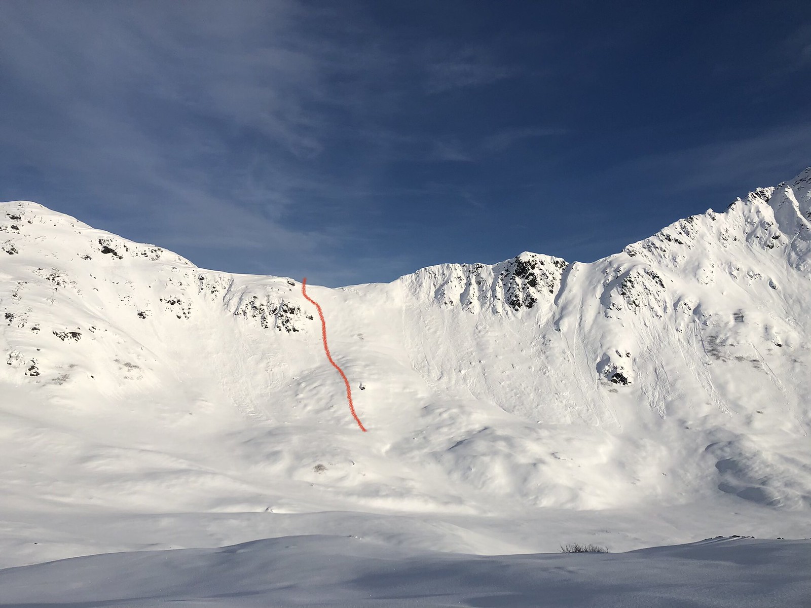 Landing Zone looking west along the ridge top.  Looking south towards Cope: glide crack exposed on a western aspect. 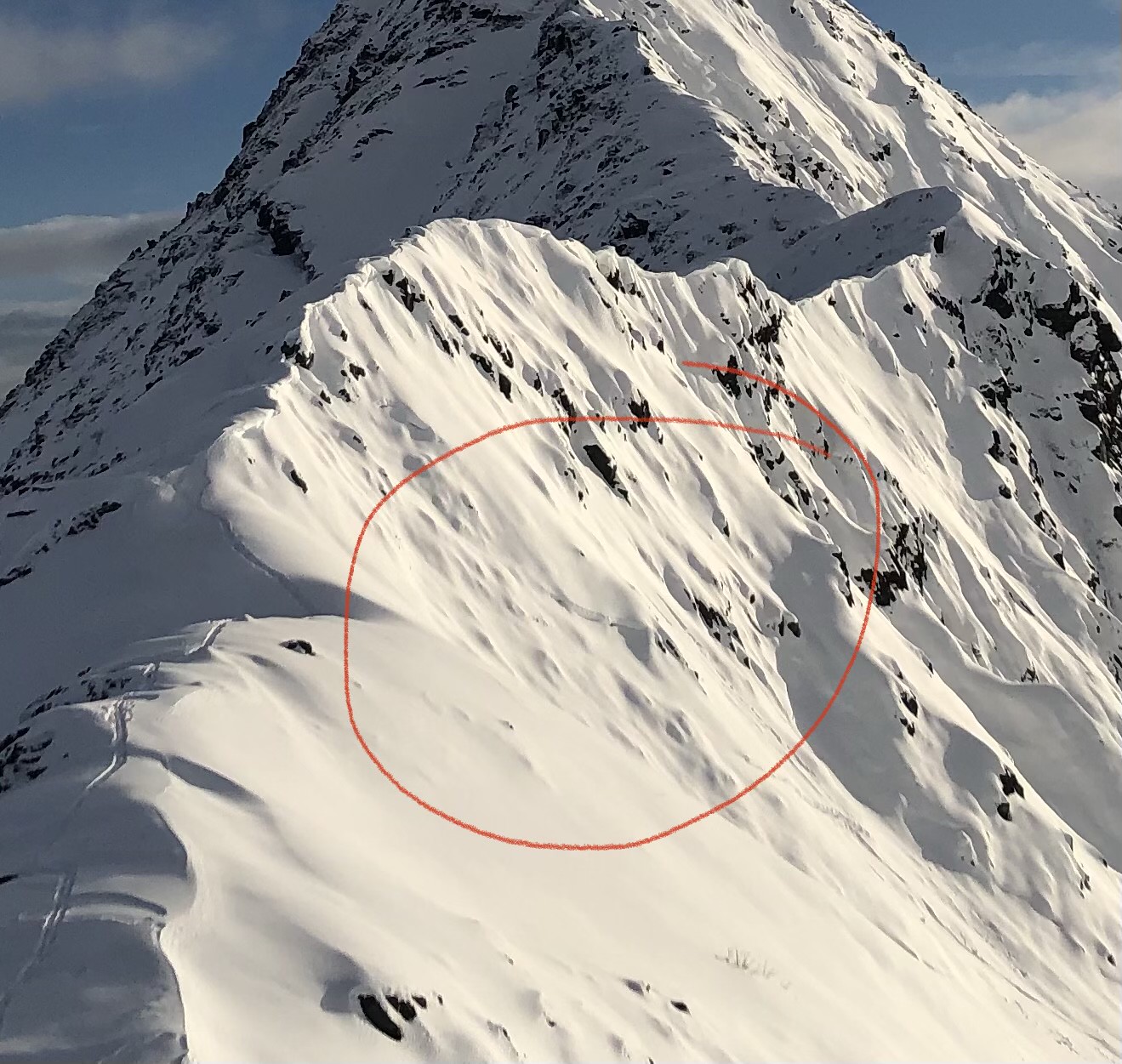 Skin track up and ski line down. 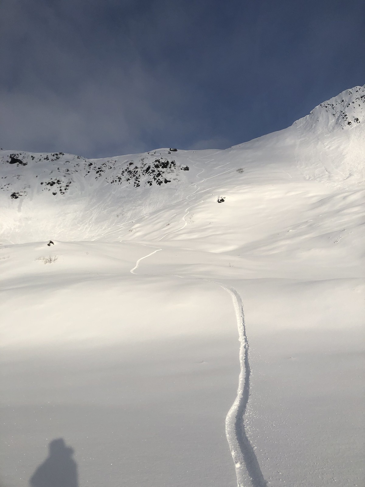 |
|

