Post by mrsquishy on Mar 2, 2017 17:11:58 GMT -9
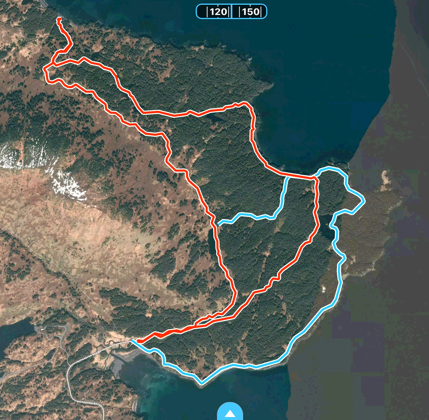
I hiked out the old ATV trail, then cut easterly at the top of the hill before the trail heads down to the cove. I followed a route through the woods I figured out a year or so ago to connect to the coastal trail at Pelenga Bay and hiked to the TP forest trail and back to the trailhead. Microspikes were necessary for the entire hike; I saw bear tracks several different places along the ATV trail, but nowhere else. On the coastal trail I found at least two deer that had been poached - it was clear that they had been butchered, especially the carcass that still had discarded paper towels around it. The poachers weren't smart enough to at least drag the carcasses away from the trail into the woods so that no one would find them. Also, someone had packed in a chainsaw and cleared some fallen trees from the coastal trail in the Pelenga Bay area.
I also saw several sets of footprints on the big beaver pond that is just off the coastal trail which surprised me; they had hiked in from the coastal trail. It's the first time I've ever seen any evidence of other hikers on this route.
The connector trail is under two miles and fairly direct. Before you start down the hill to the cove, look for a short trail to the right which leads down a steep bank to a stream, the continues up a steep hill on a well-traveled trail on the other side. The first 0.4 miles from the stream follows a well-defined game trail then turns left at a T intersection marked by one of those sports team flyswatters hanging on a tree. Continue a short distance to a group of blowdowns and turn right down hill and cross the stream, then bear left. At that point you pretty much need the GPS track to stay on route. I'm happy to email the gpx file to anyone who wants it - routefinding in the woods is pretty challenging as opposed to being up high. Due to blowdowns since I figured out the route, I had to do a little bit of bushwhacking through salmonberry patches in a couple places.
The loop I hiked today was 8.5 miles with 1.5K total elevation gain.
One could hike a Monashka "Super Loop" by hiking the Monashka Loop clockwise from the parking lot and diverting to this connector on the ATV trail and over to either of the TP trails.