|
|
Post by steve on Sept 9, 2013 0:09:28 GMT -9
The North side of Sharatin can be accessed from the Small Creek trail that starts at the end of Anton Larson Rd. just left of the Three Pillars Pt. plastic trail. Follow Small Creek trail for about five minutes, climb steep to the right then as the trail becomes less obvious follow the flagged route. After a small meadow the route climbs into the moss floored Spruce Forrest. Heading South and climbing for the next two miles you eventually gain the alpine and a rocky ridge on Sharatins North bowl. If you have the time you can check out the old B-18 crash www.kadiak.org/crash/ or climb Sharatin and hike thru to the Red Cloud trail. This is a pleasant walk in the woods, but it's surrounded by alders, creeks, ponds and ravines. Don't get lost! 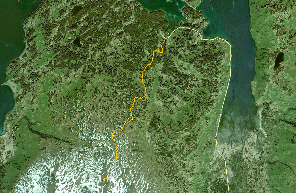 |
|
|
|
Post by Philip on Sept 9, 2013 15:17:21 GMT -9
Nifty! Thanks for doing that work, I can't wait to wander up there and check it out. If anyone wants to put the (approximate) route on their GPS, here is the .gpx file. Just right click the link, and select the Save Link As... (or similar) option, save it to your computer, and then put it on your favorite handheld GPS unit. On Garmins, it would go in the Garmin > Garmin > Custom Maps folder. dl.dropboxusercontent.com/u/10241410/Sheratin-N-Tr.gpx |
|
|
|
Post by steve on Sept 17, 2013 0:44:14 GMT -9
Started at the end of Anton Larson Rd. and hiked six hours threw to the Red Cloud trail head, then a ten minute bike back to the truck.
Explored around Sharatin's stunning North bowl and over to Shelly's lake. Numerous waterfalls, ponds, meadows and rocky knolls.
Very easy climbing threw the forest and no bushwhacking, if you follow the flags.
Ran across a Cadastral Survey Section corner Brass cap.16.15+,21,22 from 1971 and adjacent three foot high rock cairn monument.
|
|
|
|
Post by Philip on Sept 17, 2013 21:53:05 GMT -9
I hiked up the new route today after work. I left town at 3:30 sharp and was on the saddle looking down at Shelly Lake by 6pm. I dawdled on top for about 20 minutes and then headed down. I was back in town by 8pm. First off, GREAT route. Super job to the folks who put in the effort. It is a vast and confusing area, so I am doubly impressed by the relative straightforward nature of the climb out of the trees. The gradients are reasonable, the trail is fairly brushed out in the trees and very well cleared in the salmonberry patches, and the flagging is ample and easy to follow (for now). Despite that, I would still HIGHLY recommend that anyone use a GPS with the .gpx file I linked to above if you want to follow the route, at least the first few times to learn it. Sheratin is totally unforgiving if you lose the trail for some reason and woe be to him/her who ends up in the high country in the fog! Nightmare. I did field-check the .gpx file today, and it is dead-on in nearly all spots. Use it. Lots-o-flagging:  The open areas are nicely cleared (the trail goes up the middle of the pic): 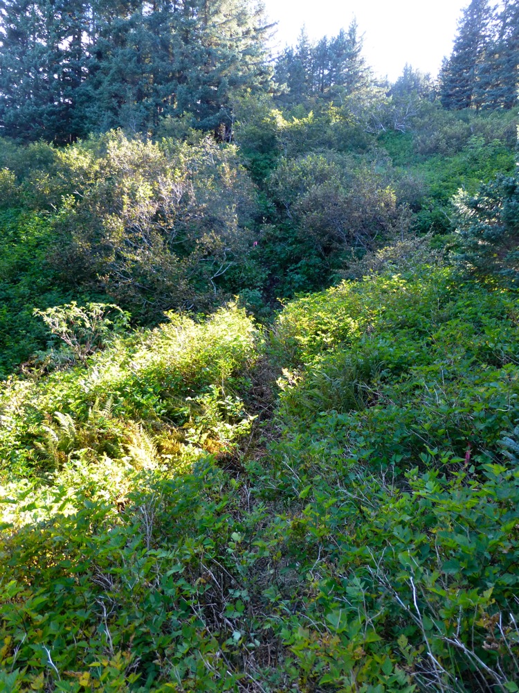 The trail goes through some classic forest muskeg before breaking out into the alpine: 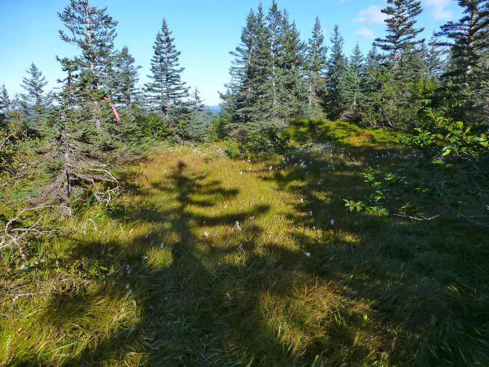 Almost out of the trees now: 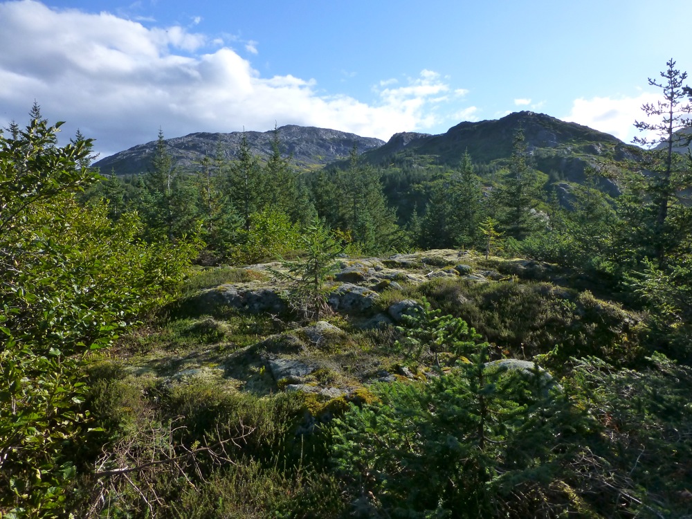 In the alpine: 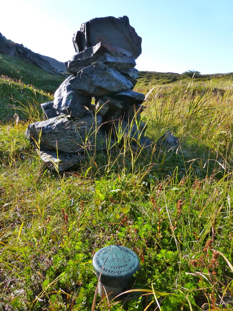 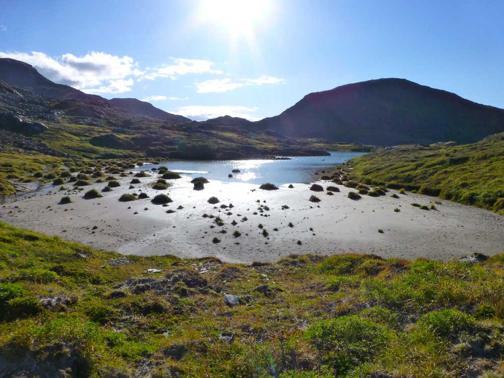 A lake up high with Whale Island in the background: 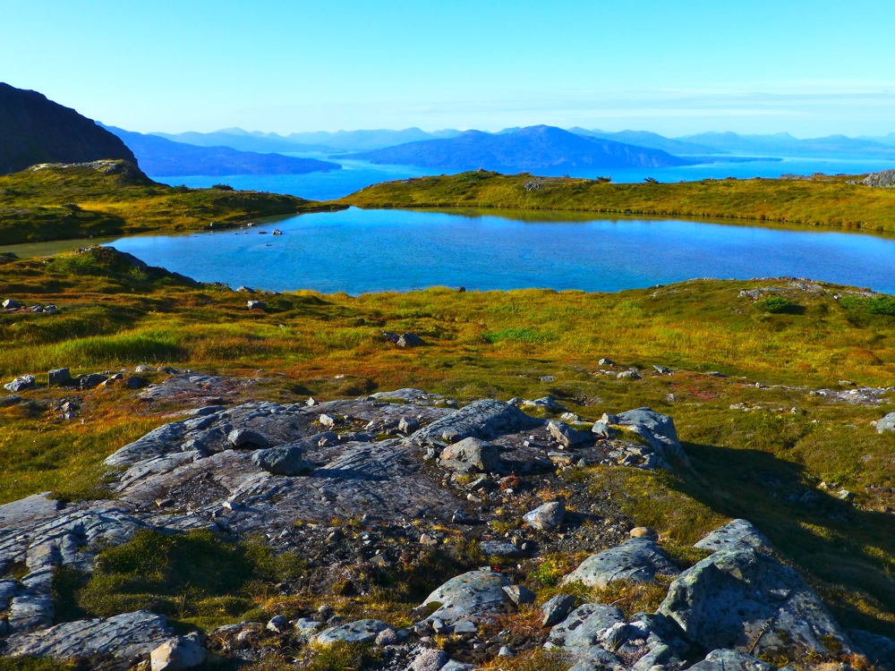 On top of the west buttress looking down on Shelly Lake: 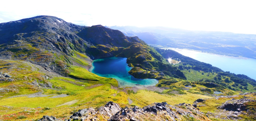 The colors in Shelly Lake rarely disappoint: 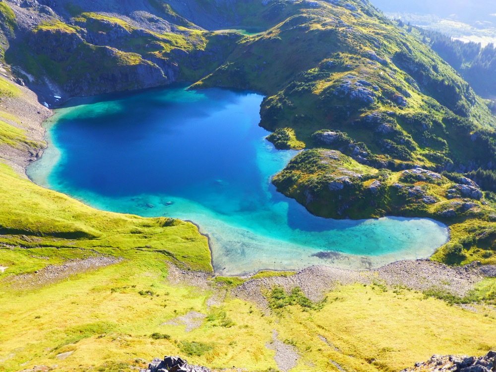 The starting point at Anton Larsen Bay is center left in the image and you climb up past the lake in the middle of the pic. The ridge on the right leads to the summit: 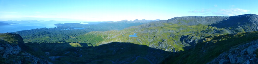 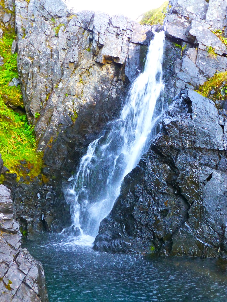 Headed down: 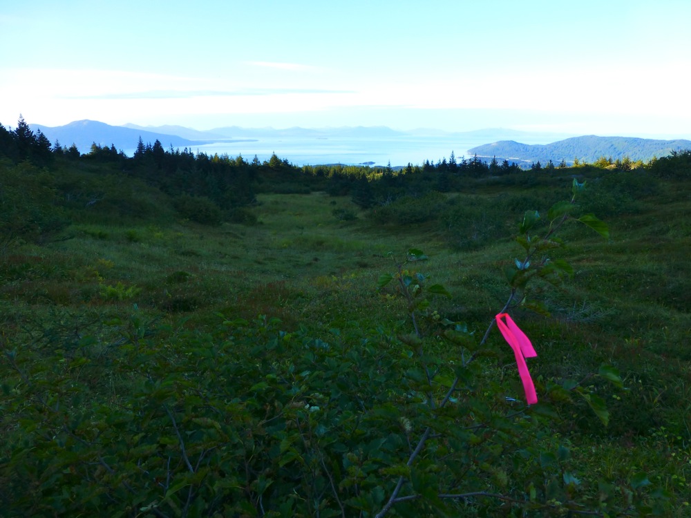 |
|
|
|
Post by steve on Sept 17, 2013 23:16:40 GMT -9
Great photos!
Good to hear you enjoyed the route. Yes! recording the route on your own GPS is a good back up plan to make sure you get back to the trail. Sharon and I used GPS twice to get back. Once in the fog, and once in the trees in the dark. Great fun!
So Philip, three hours round trip, were you trail running?
|
|
|
|
Post by Philip on Sept 22, 2013 15:32:54 GMT -9
Did the loop today by stashing bikes at the Red Cloud trailhead and then driving to the end of the road. We climbed the new route, headed over to Shelly Lake, descended to the shore and walked around the Sheratin Bay side of the lake, then climbed up and over the summit of Sheratin and came out via the Blue Room and Red Cloud trail. There was a 'fresh breeze' blowing on top (coulda' blown the hair off a bear) but otherwise spectacular. A serious pack of termination dust on the summit. I would have taken pics of that but my camera battery had other plans for the day. The counter-clockwise loop. We biked the road section: 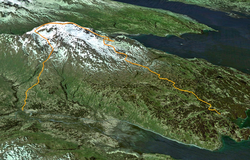 Emerging from the forest. It was a tail wind the whole way: 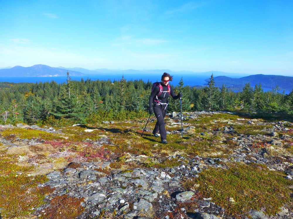 Descending to Shelly Lake: 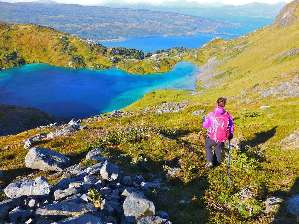 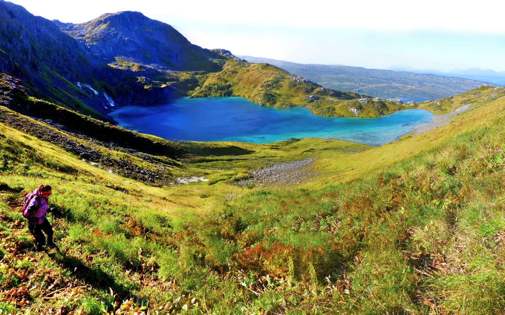 Around the far side and headed toward the summit. That's where my camera battery died... 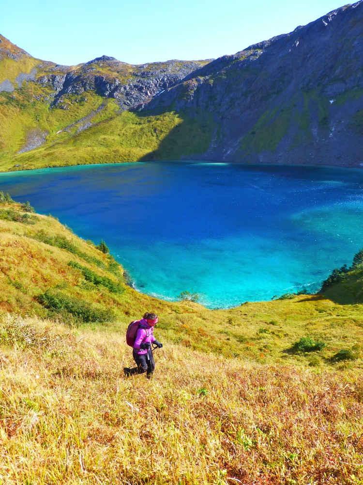 |
|
|
|
Post by adelia on Sept 22, 2013 19:46:49 GMT -9
I just wanted to add my thanks to Steve and helpers for all their hard work making this trail. It was great -so nice to have another loop option now too!
|
|
|
|
Post by brooks on Nov 3, 2013 18:58:51 GMT -9
Sat 11/2/13 John and I did the Sharatin loop. On the way up from the Red Cloud River side 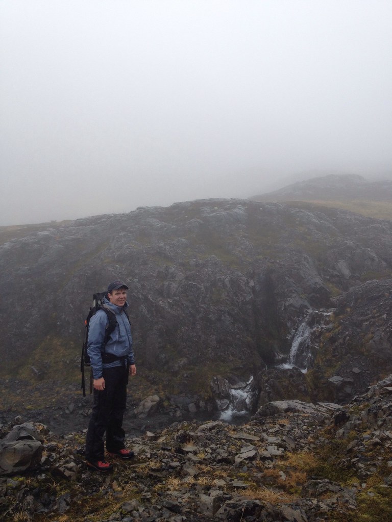 Winter is starting 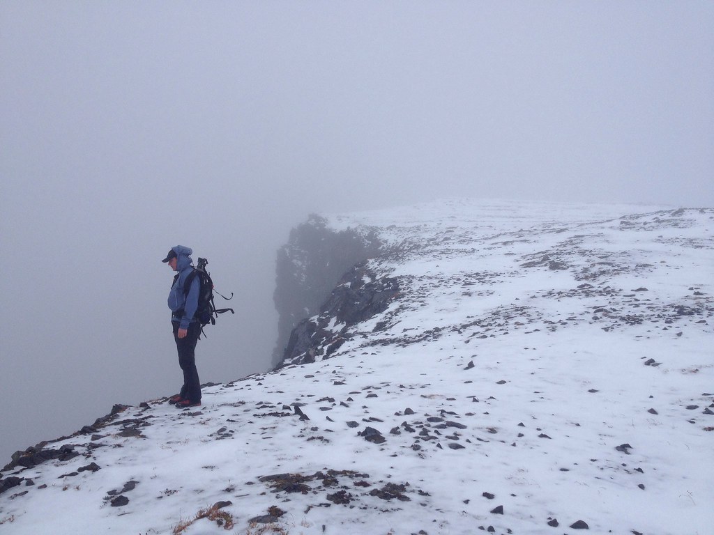 The B18 wreckage 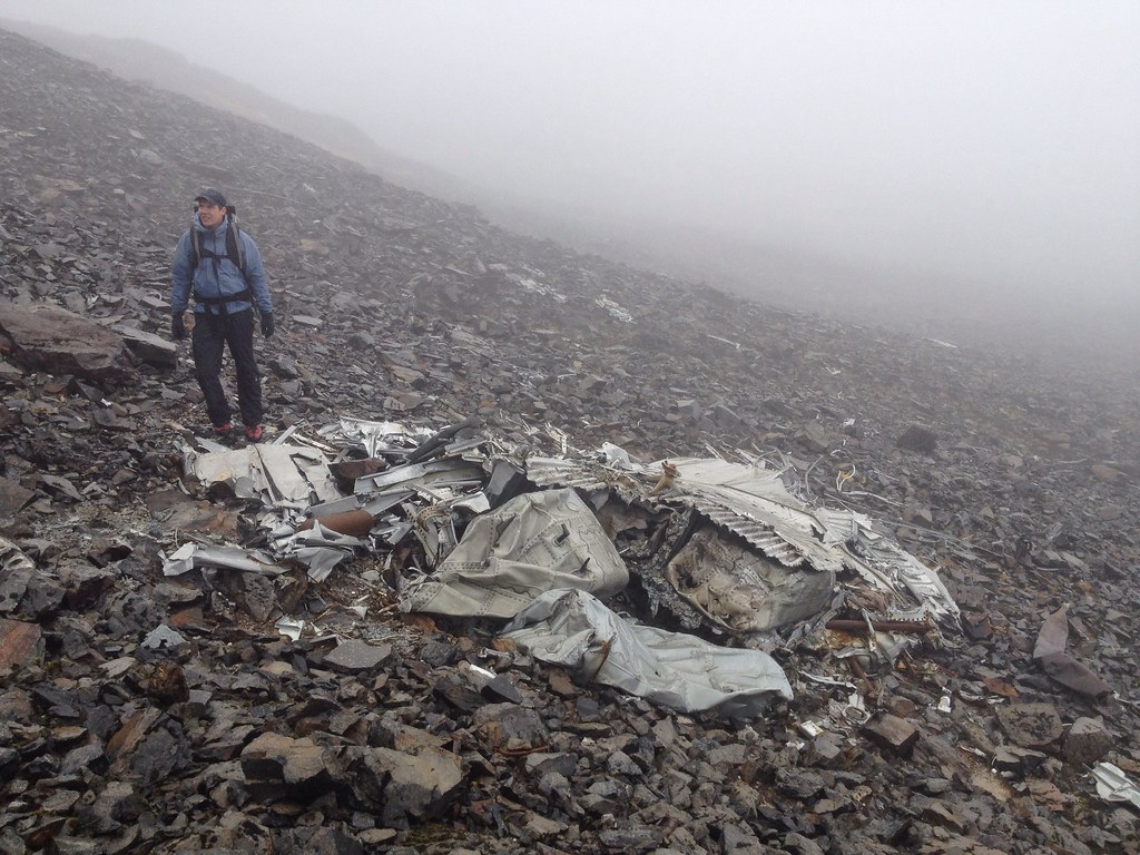 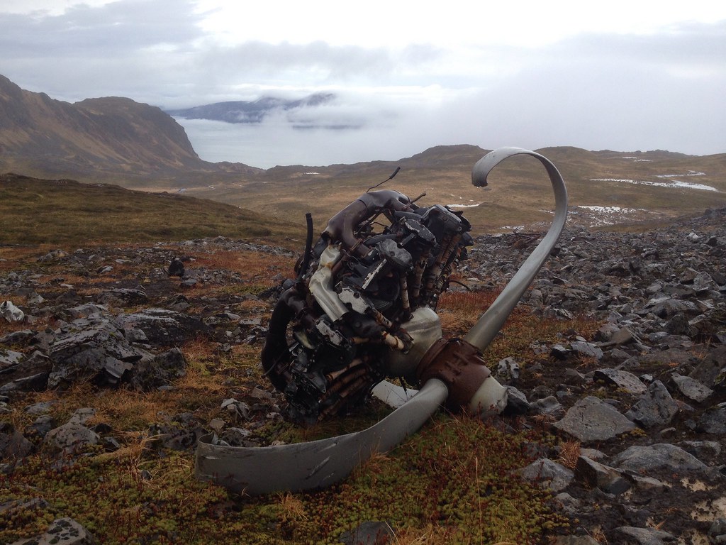 The route down towards the end of the Anton Larsen Bay Rd side 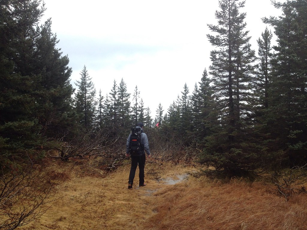 Through the forest 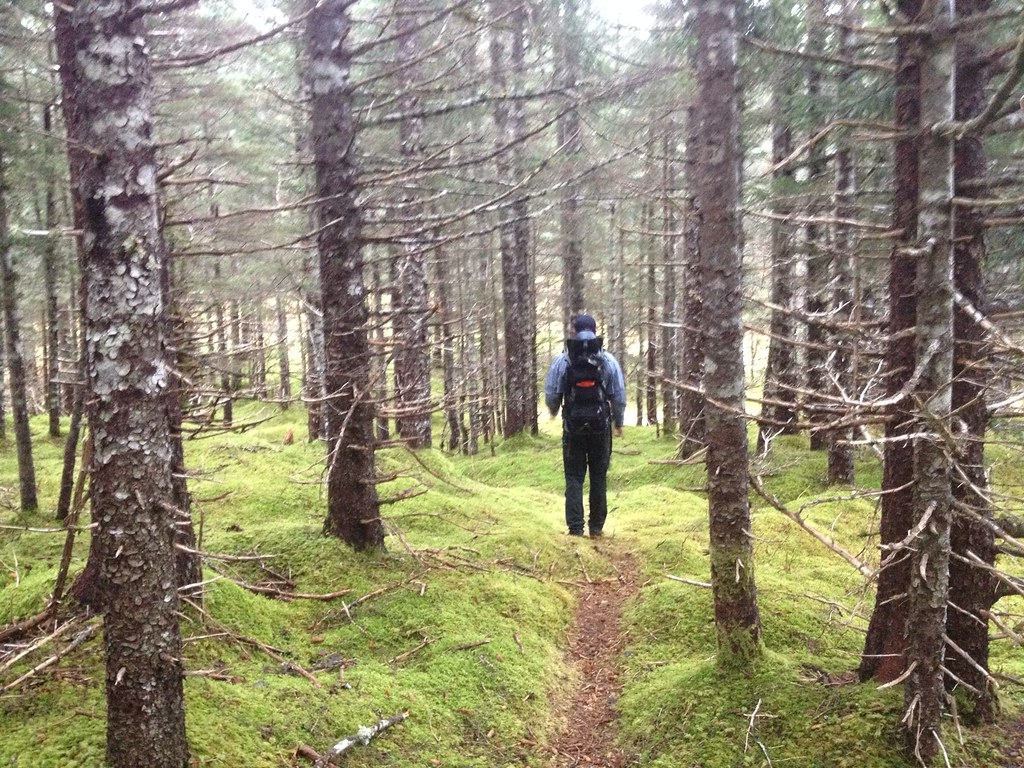 The trailhead on Sharatin North Side at the end of Anton Larsen Bay Rd 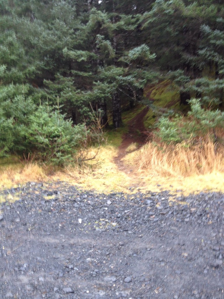 |
|
|
|
Post by steve on Nov 4, 2013 17:27:17 GMT -9
Sharon and I hiked the North side trail up and over to Shelly's Lake and then Northwest down to Sharatin bay at the saltwater lagoon. There is a foot trail from the NorthEast bank of the Lagoon(about200feet) that leads to a 4-wheeler trail all the way back to the 3Pillar plastic trail. The round trip is about 10 miles. Caution!! About 5 minutes after leaving Shelly's Lake the route was steep bushwhacking in salmonberry and alder. If you can stay in the trees it's better going and there's more trees the further down you go.
|
|
|
|
Post by Philip on Nov 4, 2013 19:18:40 GMT -9
I've climbed up to Shelly Lake from Sheratin Bay. Total brush nightmare. The rest of the loop as you described is pretty cool though.
|
|
|
|
Post by bodymkanic on May 26, 2014 8:02:24 GMT -9
Took a walk on this one on 5/24 and spent the night in the bowl overlooking Shelly Lake. What a great hike. Decided not to push up onto the ridge this trip with the pack but will definitely be back to do it again. There is still plenty of snow up there for those of us that winter in warmer climes to get our share in the white stuff. Many thanks to all that worked to make this one accessible with limited likelihood of getting lost. There are still lots of opportunities to get off-trail, even with the flags, so I definitely concur with all the recommendations to have the GPS along.
|
|
|
|
Post by Philip on May 28, 2014 18:53:29 GMT -9
Yup, a very cool area. Here is a distant view of the NE side of the mountain from the Triplets as of around May 25. It looks like the bowl still has some snow but the ridges have melted out. Definitely time for hiking and camping.  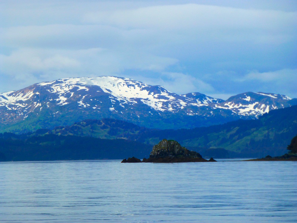 |
|
|
|
Post by Philip on Oct 26, 2014 16:03:16 GMT -9
Sunday Oct 26, 2014 Today Adelia and I hiked up the N Sheratin Trail from the end of Anton Larsen Bay Rd, over the summit, and down the Red Cloud River trail. We picked up some bikes we had stashed at the bridge, and rode back to the car at the end of the road. It was dead calm and almost hot on top of Sheratin. The upper couple of hundred feet of the peak had a uniform and firm snow layer. Some people would consider it skiable, though I thought is was simply nice for hiking on. Adelia took her gun for a walk in case we ran into a spike buck, but all we saw was a pretty big sucker and it's a little late in the season for one of those (...for our refined palates, anyway). The goats were fat 'n' fuzzy and could hardly be bothered to get out of our way. We have been having a stupendously sunny and lovely fall, and Sheratin definitely delivered the Kodiak goods today. Some nice bear tracks up on top in the snow too, though we didn't see any bears. Just deer, ptarmigan, goats, and bunnies. Blazing sunshine as we approach the summit: 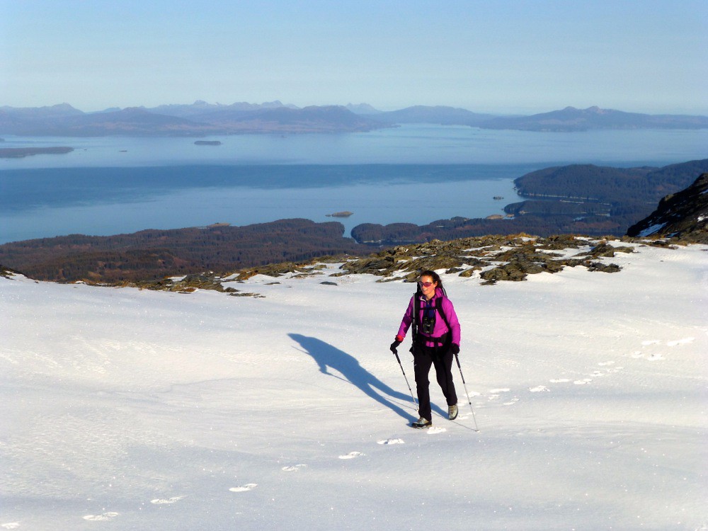 Pyramid is in the center of the image in the background. The snow base there needs some work: 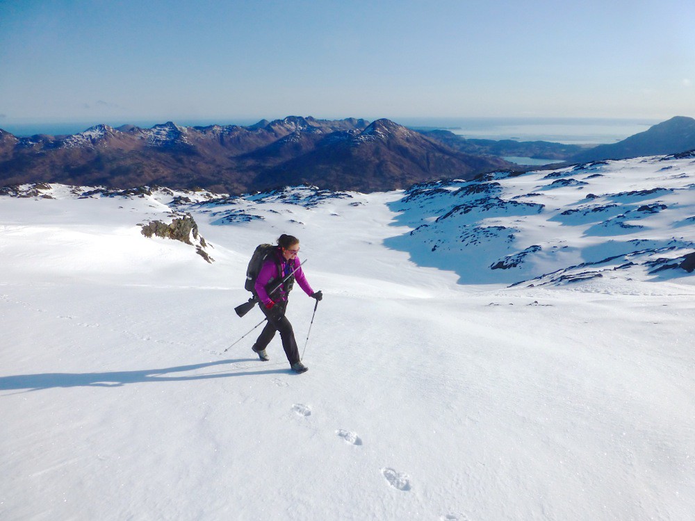 Lunch overlooking Elbow Creek: 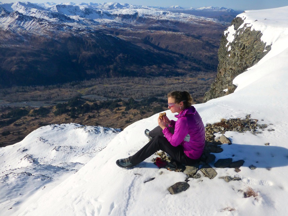 Mosey'ing to the nearby cliffs: 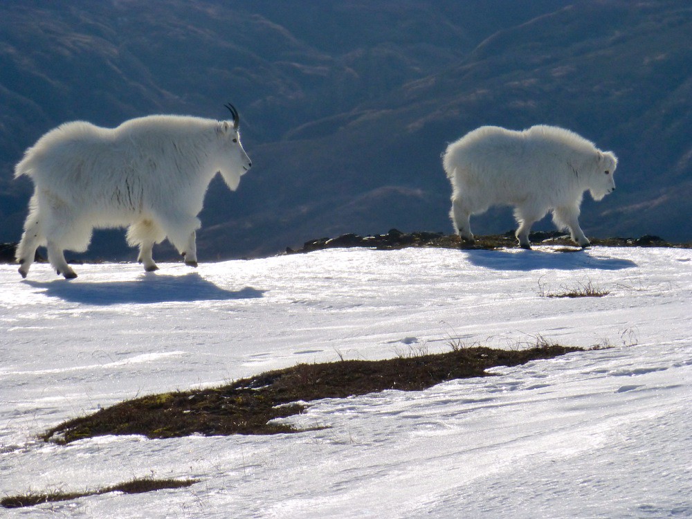 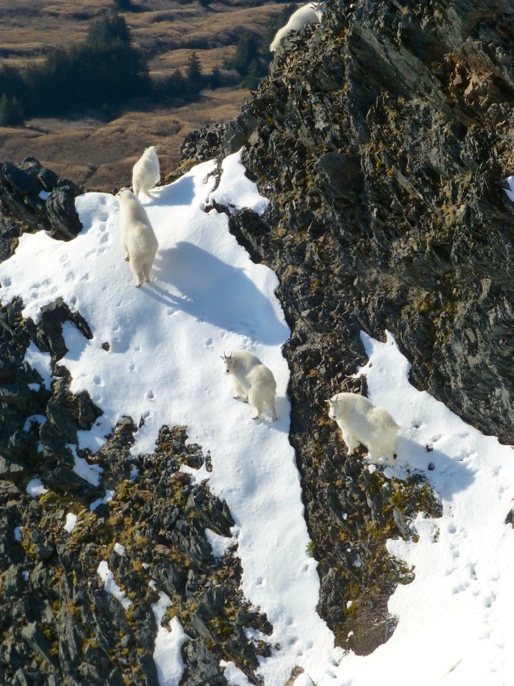 Down the Red Cloud side: 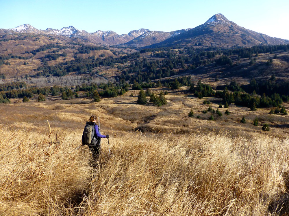 Typical Kodiak commuter setup: 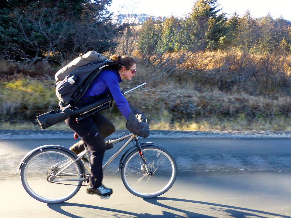 |
|
|
|
Post by John Axelson on May 27, 2015 3:19:03 GMT -9
Has anyone done this lately? I was going to check it out last weekend but was apprehensive with the weather and no GPS. This coming weekends weather gives me confidence not to get lost. I plan on camping at Shellys Lake. Does anyone know if the trail up is still flagged well? Is the lake easier to get to doing the south side or north? Thanks for the info!
PS Thanks for the flagging on the Termination to Monoshka Ridge, battled brush going up but caught the tape on the way down and it made for a much more enjoyable route!
|
|
|
|
Post by Philip on May 27, 2015 5:37:01 GMT -9
I haven't been up there in a while, but the trail should be pretty easy to follow now that it has seen some traffic these past 2 years. No worse than any other Kodiak route, anyway. And once you get to the saddle above and east of Shelly Lake, make your way down to the lake aiming for the middle/north end of the lake, and then walk around the north end. There are some steep sections leading down to the lake and a little rock scrambling, so be careful and pick your route down (you can see the pass and descent in the image half-way up this page where I said 'my camera battery died'), especially if there is any snow. Camping on the saddle above the lake is also nice for the views if getting down to the lake looks dicey. There is water available everywhere. There is a small and relatively flat meadow just on the far side of the outlet of the lake that would be good for camping if you get down to the lake, and it's nicely protected from the wind.
|
|
|
|
Post by kodpvd on Aug 24, 2015 12:03:30 GMT -9
Hiked the Sheratin Loop Trail yesterday starting from the end of the road. The scenery was great, but very windy after we broke out of the tree line. This image shows our route (via Runkeeper) and the original Sheratin North Route (in green dots) posted by Phillip. The imagery backdrop is from the Borough's GIS system. We didn't have a GPS track to follow on the way down, so there was a little route-finding before we caught the trail down to Red Cloud River. We parked cars at both Red Cloud and the end of the road. I'd love to go back up there when the wind has died down.  |
|
|
|
Post by Philip on Aug 26, 2015 18:35:16 GMT -9
Nice work. It is a wonderful loop, especially in June when there are more bears and wildflowers in the high country. Keep up the hikin'.  |
|
|
|
Post by Philip on May 1, 2016 16:00:23 GMT -9
I hiked up and then back down the Sheratin north trail on Saturday. The recent heavy rains made the trail very wet with lots of flowing and standing water in places. The bottom section of tail along Small Creek is pretty eroded in spots. Once you break out of the last trees into the alpine, the snow starts rather suddenly and the coverage is pretty thick and uniform (2-3 feet at least). Below the open alpine there is almost no snow at all. The snow was soft and post-holey. I'd bring light snowshoes and Microspikes if I were to continue climbing higher.
|
|
|
|
Post by John Axelson on Jun 10, 2016 18:34:25 GMT -9
Can anyone dig up coordinates for shelly lake?
|
|
|
|
Post by Philip on Jun 15, 2016 8:13:13 GMT -9
57 49.39 N
152 41.96 W
It appears in some satellite views, but is frozen over in others and is not on topo maps.
|
|
|
|
Post by Philip on Mar 12, 2017 18:00:25 GMT -9
Sunday March 12, 2017 I hiked and snowshoed to the Shelly Lake overlook today. There is about a foot more snow at sea level on the Anton Larsen side of Pyramid Pass. The XC skiing along the Red Cloud River would be really good. Too bad we never cut any trails. Oh well. The North Sheratin Trail itself is very icy in the beginning until you are on consistent snow under the trees, about half way up. You would be really stupid to attempt it without Microspikes and poles. But once the snow starts, things are good. Some other snowshoers had been up ahead of me and packed the trail in nicely. They deviated from the summer trail in a few spots, but obviously knew where they were going. If you are not familiar with the area now is probably not the time to do it since the trail down lower in the forest can be hard to follow with the trail bed often obscured by a thin layer of crusty snow. But if you know where to go, you can get through that section and then enjoy a nice packed trail up higher. The snow where it is protected by trees and brush is wonderful with a good 8" of storm powder everywhere. As you exit the trees it becomes wind-affected. I didn't see anywhere that looked like decent, consistent skiing, but it was nice for snowshoes. The road is plowed right to the end, but is slippery in a few spots so take corners slowly, especially at the end. This will give you an idea of the snow accumulation up near treeline. There is a solid 3-4 feet coverage. 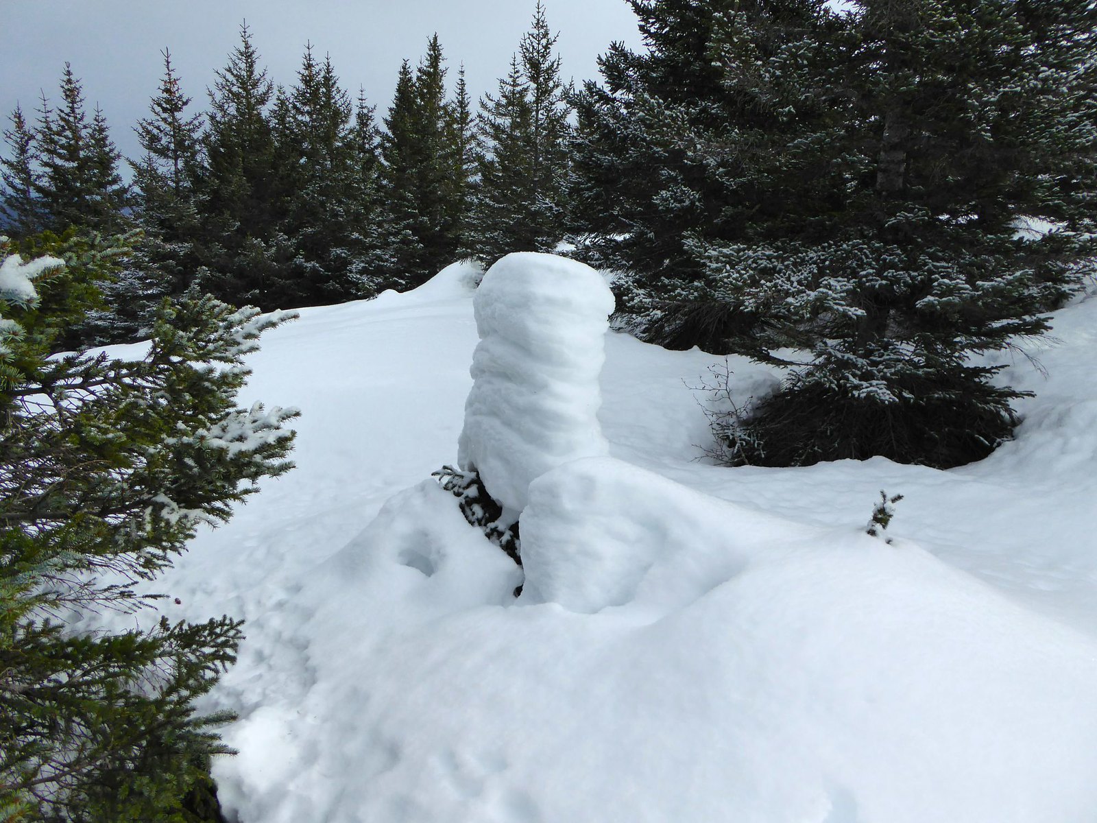 Leaving the trees and looking towards Whale Island: 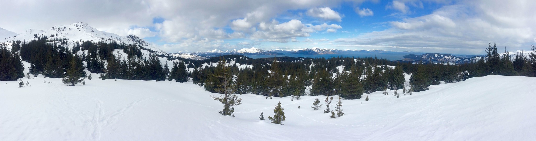 |
|
|
|
Post by Philip on Apr 8, 2018 22:03:58 GMT -9
Sunday April 8, 2018 I popped up the Sheratin North Trail today as it was a suprisingly lovely day. As usual, the Anton Larsen side of the Pyramid Pass has more snow and generally colder conditions, and now is no exception. There is still some snow at sea level, and there is ice on the trail down low. Microspikes are recommended though not strictly necessary. I hit enough snow to switch to snowshoes between 500 and 700' elevation, about a mile from the trailhead. From there there is plenty of snow even in the dense forest to require snowshoes or skis. The snow is sort of punchy with a semi-crust on top and softer below. Someone had been up ahead of me in the past week with snowshoes, so there is somewhat of a trail beaten in, but with the precipitation forecast this week some of that track might get filled in. Anyway, I climbed to treeline and was kind of tired from breaking through with every step so just climbed the first big dome above the trees and declared victory. There is a solid 4+ feet of snow up higher that looks like it will stick around for a while so if folks want to ski the north side of Sheratin, there is plenty of time. I also saw my first bear tracks of the spring up there. A relatively small bear, but I guess they are waking up. I also heard a few varied thrushes singing in the forest. Sure signs of spring along with the salmonberries sending out proto-leaf shoots. 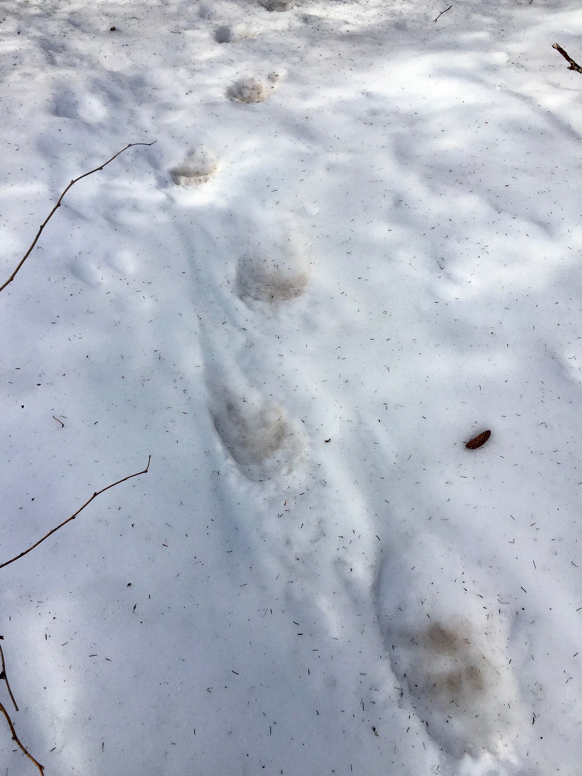 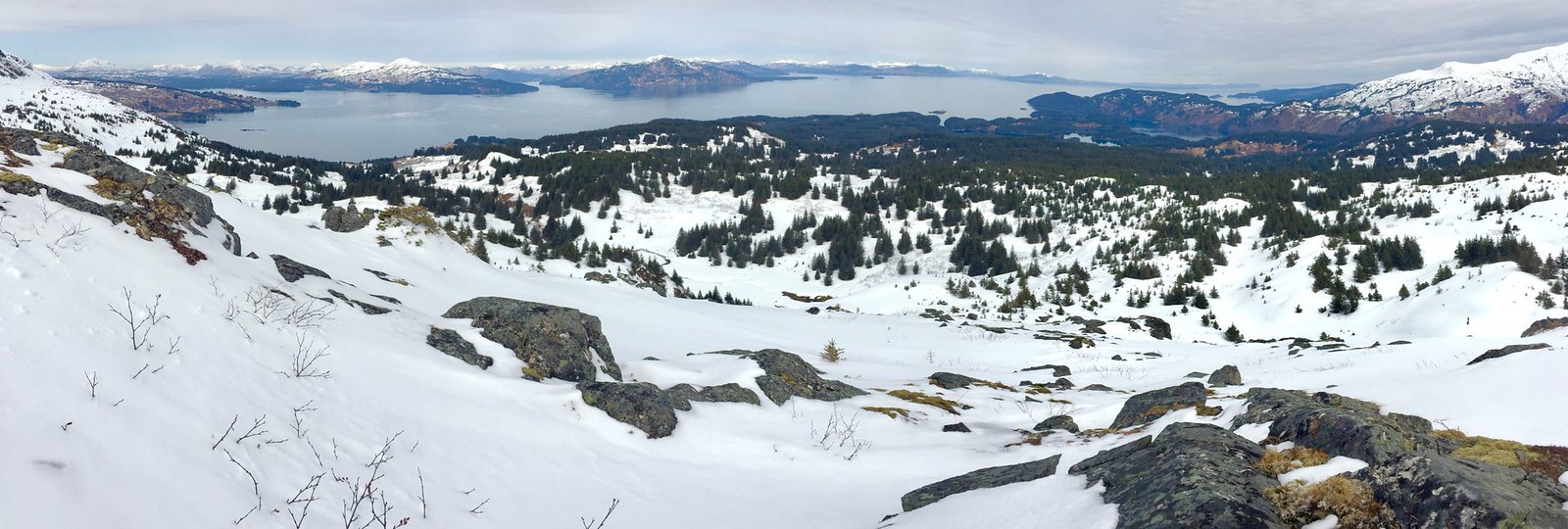 |
|